Gindalbie Gold Project
| Gindalbie Project Overview | |
| ELs | E31/1113, E27/550 & E27/549 |
| EL Status | All granted |
| Project Craton | Mafic volcanic/intrusive lithologies within the Kalgoorlie Terrain of the Yilgarn Craton |
| Project Area | 924 km2 |
| Target Commodity | Gold |
| Target Stratigraphy | Mafic volcanics and intrusive lithologies |
| JORC Resources | None |
| Available Reports | Annual Technical Reports, WA Department of Mine and Petroleum reports |
| Proximal Major Projects |
|
| Exploration Program | |
| E31/1113, E27/550 & E27/549 | Compilation of historical exploration, aeromagnetic/radiometric survey at minimum line spacing of 100 m, geological/regolith mapping and targeted soil sampling. In selected RAB/Aircore drilling of high priority targets. |
| Land Owners | Gindalbie, Hampton Hill and Menangina South Pastoral Properties. All landowners have been contacted and are supportive of Kaili exploration programs |
| Native Title Claims | Maduwongga People WC2014/002 (Currently not accepted for registration. In addition, the Native Tilte Act covers registered and unregistered sites of significance. |
| Environmental Considerations | No significant areas of state/local government environmental significance. |
| Exploration Objective | Identification of economically extractable gold resources within mafic volcanic/intrusive lithologies of the Yilgarn Craton. |
Introduction
Kaili’s Gindalbie Gold Project is situated 65 km north of Kalgoorlie within the Yilgarn Craton region of Western Australia and 550 km north east of Perth (FIGURES 1 & 2). Access from Kalgoorlie to the tenements is along the sealed/unsealed Yarri Road passing the Black Swan Nickel Mine and Kanowna Bell Gold Mine. The Kalgoorlie region has a large skilled workforce and excellent infrastructure for the development of gold projects.
There are station tracks along fence lines and elsewhere that afford access to the other parts of the property.
Land tenure and physiography
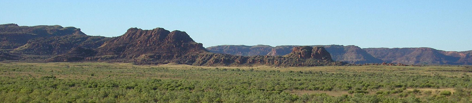
The topography is subdued and characterized by low rounded hills with the relief ranging between 100 m and 200 m. The only prominent topographic features are low extensive scarps or “breakaways” that commonly mark an abrupt junction between the “old” and “new” plateau surfaces and only occur in deeply weathered or kaolinized rock.
The climate is semi-arid with an annual average rainfall of between 225-250mm. In general, the rainfall is more reliable in the south. Flood rains occur occasionally caused by cyclonic conditions originating from the northwest. Summers are hot and dry with maximum temperatures frequently above 360C. The winter is cool to mild with occasional frosts.
Vegetation is varied and belies the semi-arid nature of the climate. Dense mulga scrub interspersed with tracts of more open bluebush (Kochia), saltbush (Atriplex), and eucalyptus country is common north of Lake Yindarlgooda. The sandier areas are covered with mallee, spinifex (Triodia), and occasional native pine (Callistris). Open eucalyptus woodlands comprising salmon gums, gimlet and mallee, interspersed with saltbush and bluebush cover the flat and undulating country of the south. Vegetation density increases toward the southern margin of the Sheet. The salt lakes or playas are bordered by saltbush and numerous varieties of samphire. Native pines are common on kopai dunes (gypsum) bordering the salt lakes.
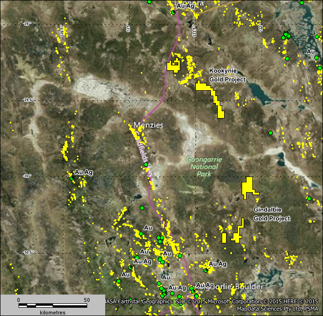
FIGURE 1 Satellite image showing Gindalbie and Kookynie Gold Projects
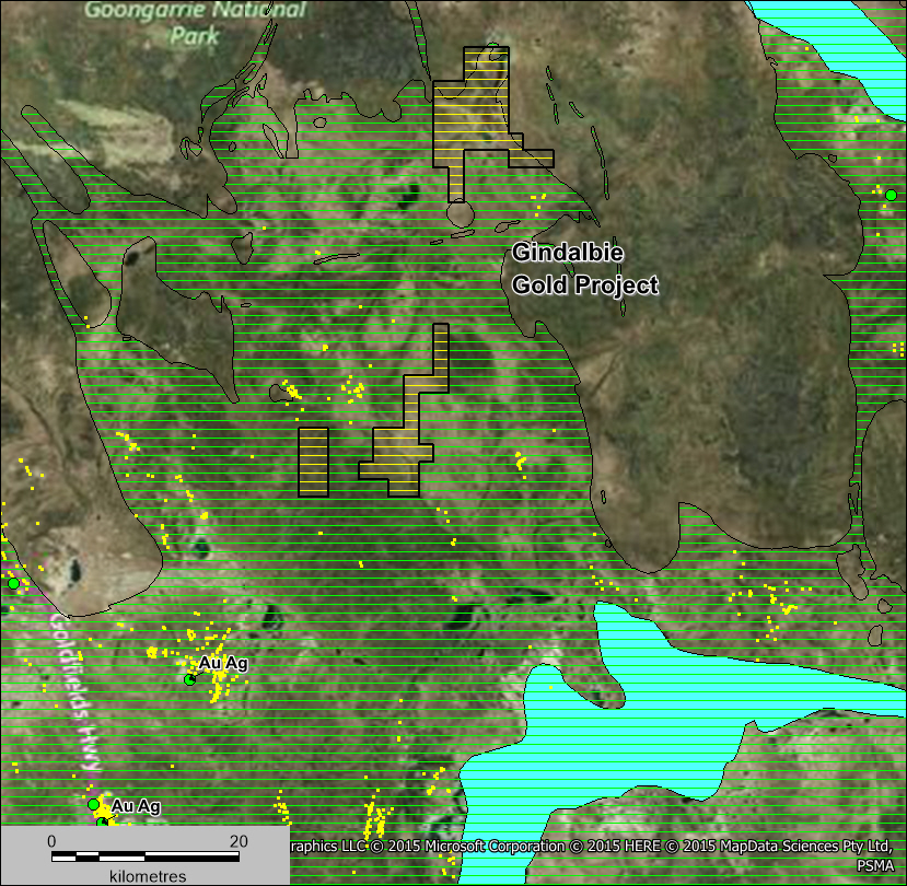
Figure 2 Satellite image showing Gindalbie Gold Project (3 tenements) and the location of operating gold mines (green dots) and gold occurrences (yellow dots) the blue area in the south east is a salt lake
Geology
The Gindalbie project is situated in the central part of the north northwest striking Archaean greenstone belt that runs between Norseman and Wiluna and Gold lies within the Eastern Goldfields terrain of the Archaean Yilgarn Craton approximately 60km north east of Kalgoorlie and on the southern and eastern flanks of a N-S trending syncline filled with sediments.
The bedrock sequence is mainly exposed in the south-western portion of the property where a north-north-west striking sequence of Archaean rocks is known. The sequence comprises felsic and mafic (shades of green) volcanics and intrusives including dolerite, gabbro and basalt as shown in FIGURES 3 AND 4.
 Superficial cover is present over much of the area comprising Cainozoic colluvium and laterite and Quaternary alluvium.
FIGURE 3 Gindalbie Gold Project – Interpreted Geology
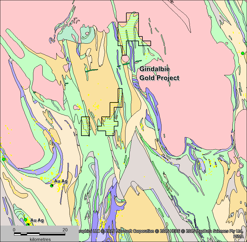
Figure 4 Gindalbie Gold Project – TMI Aeromagnetics and Major Structures
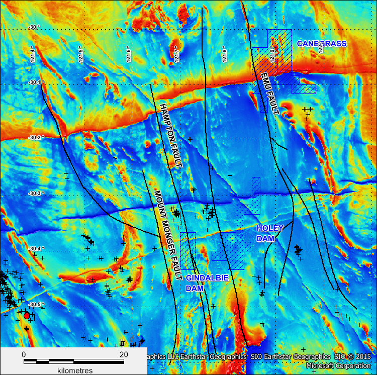 Several regional gold mineralised structures cross the Gindalbie tenements (FIGURE 4)and will be the focus of ongoing exploration.
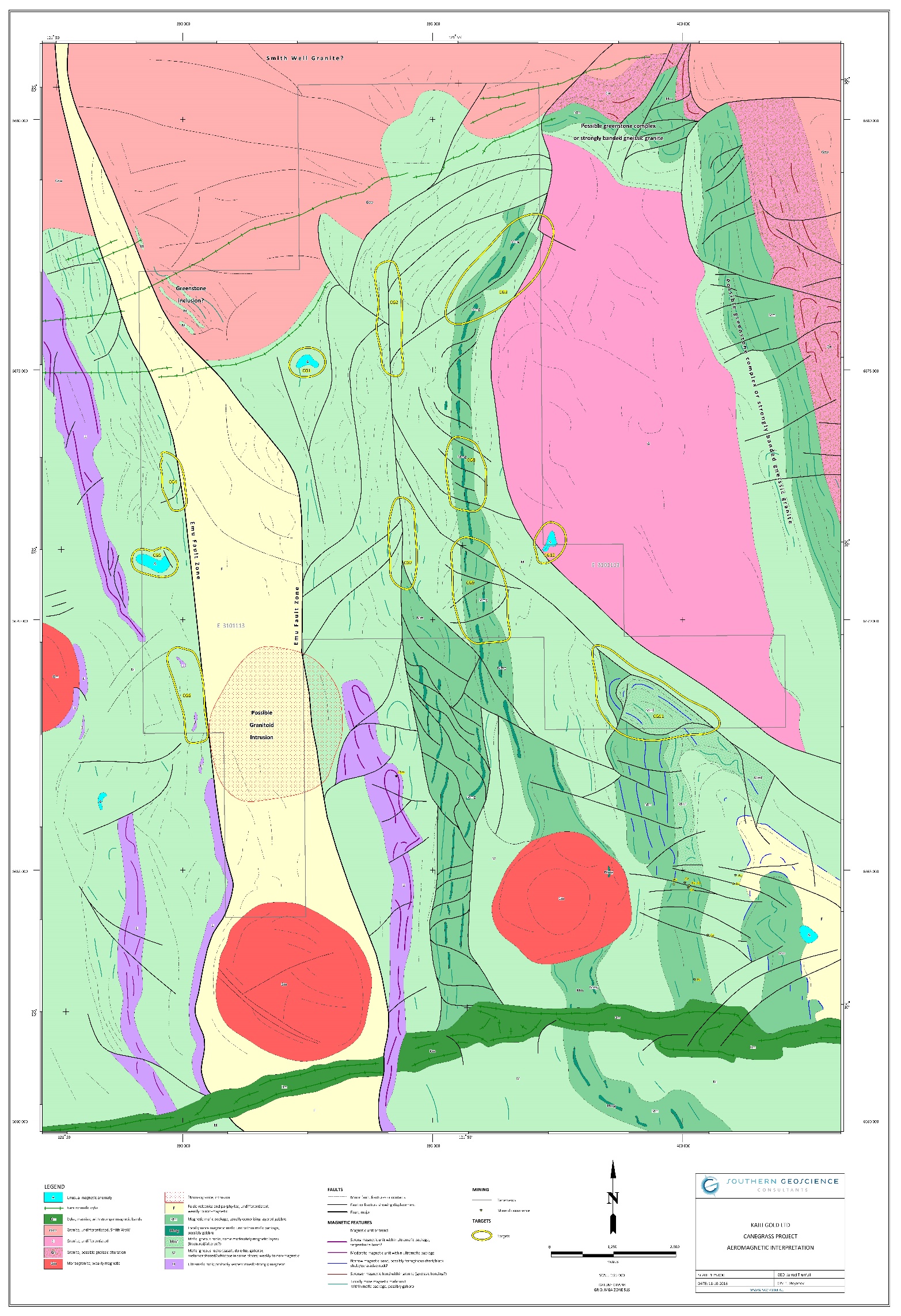
Figure 5 Canegrass Project – Interpreted Geology and Targets